|
Documentaries
Press
|
Rated 1.41/5
|
![]()
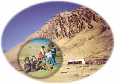
The Cusichaca Valley
The next day we started of climbing a 5.300 m mountain pass. Only the horses carrying our luggage stayed with the group. The other horses and the two cowboys returned home to Mollepata.
 The
biggest problem in the high andes is lack of oxigene. Every step feels like moving
a thousand kilos. On the other hand, a mountain pass usually rewards with a fabulous
view. The sky was totally clear and we could see hundereds of kilometers far. Even
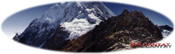
the highest mountain of the area was visible, the Ausangate.
Its huge white summit glittered in the sun, a 250 km east from the Salcantay. Far
away a condor crossed the sky, was this the Apus Ausangate?
The
biggest problem in the high andes is lack of oxigene. Every step feels like moving
a thousand kilos. On the other hand, a mountain pass usually rewards with a fabulous
view. The sky was totally clear and we could see hundereds of kilometers far. Even
the highest mountain of the area was visible, the Ausangate.
Its huge white summit glittered in the sun, a 250 km east from the Salcantay. Far
away a condor crossed the sky, was this the Apus Ausangate?
We now only had to follow the Cusichaca Valley all the way down to Wayllabamba. It took us two days to get there. After walking down all day, we arrived in a village of 5 houses and a little school. We camped just in front of the school. The next day we had to leave before classes started at 9 in the morning.
And finally we got to see the first ruin
| The Inca Trail
External links
|
©2024 InfoPeru Best 1024 x 768 |
| Top | Cities | Machu Picchu | Inti Ramyi | Inca Trail | Incas | Email | Sitemap | About |
18924 visits