Location:
South sierra (Andes) of
Peru, in the
limit with Bolivia.
Area: 27 800 Sq miles.
Capital: Puno (12,555 feet above sea
level)
The Lowest altitude: 2690 feet above sea
level (Lanlacuni Bajo)
The Highest altitude: 15 502 feet above
sea level (San Antonio de Esquilache)
Climate: Annual average temperature is
50ºF (the highest altitude of 66.2 ºF
and the lowest one of 35.6 ºF). The
rainy season starts on December and it
lasts until April.
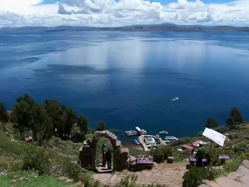
Taquile
How to get to Puno?
By air: Domestic flights from
Lima to Juliaca (1 hour and 45 minutes approx.).
Arequipa – Puno (45 minutes approx.).
By land: Lima –
Arequipa – Juliaca –
Puno, 810 miles (24 hours by car
approx.)
Cusco– Juliaca (8 hours approx.).
Arequipa– Juliaca (6 hours approx.)
The department of Puno is located in the
southeast area of Peru. In the shores of Titicaca Lake and over 12 555 feet above
sea level. It has an uneven topography
with the majority of cities located in
the high areas of the sierra. It has 27
947 Sq miles and a population of a
million of inhabitants.
Among the most important cities are:
Juliaca, Azángaro, Huancané, Lampa and
Yunguyo. The amazing Titicaca Lake which
is the most navigable lake of the entire
world with an area of 8,560 km2 and a
maximum depth of 745 feet, the
transparency of its waters is
remarkable.
There are 36 islands and the most
important are
Taquile and
Amantani.
The National Reserve of Titicaca has a
great beauty; it has an enormous area of
Totora (an aquatic plant) that contrast
with the water mirrors of the lake. This
natural area protects 87 varieties of
birds such as: flamencos, huatallas,
keles and tiquis as well as 26 species
of fish (such as carachis, pejerreyes,
trout, suches and ispis) and 18 species
of amphibians among them the giant frog
(La rana gigante or Keli) that lives
just in the depth of the lake. Puno is
the folk capital of Peru because its
variety and the beauty of the music they
have and obviously its dances (it has
more than 300 different dances, among
them la endiablada, la morenada, la
llamerada, la marinera puneña and la
pandilla puneña). Now days, Puno is an
important agriculture and livestock
region, owner of a great tourism
potential. A great group of floating
islets of Totora making the Floating
Island of Uros, an island where the
inhabitants continue living as their
ancestors did, ¡Over the water!. The
drought season, ideal to visit Puno, is
between May and August. The highest
temperatures are between November and
February and the lower ones are between
June and August. It is advisable to
combine your visit to Puno with the
destinations of
Cusco and Arequipa.
|